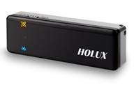
I recently picked up a Holux GPSlim 240 bluetooth unit - it's got the SiRFstarIII chipset, and the whole package is barely the size of my thumb. I have been having some fun with it with various PDA-based and laptop-based software packages for navigation and tracking...
I have thus been overjoyed to see that one of my favorite pieces of software, Google Earth, is now looking at realtime GPS tracking... About time!
The Google Earth Blog provides an overview, along with some good insight on how the functionality works. This will add a whole new layer of fun to Google Earth!


So what have you used this GPS for and in combination with wich software and hardware? How accurate is it in use (from webpage: 5 - 25 m), I see that it only have L1, C/A code.
I also see that it is works with Bluetooth, so it is possible to program a Java-application on my cellphone which can work with it?
Lastly I am situated in Norway, and would like to buy it cheap online, where is this possible?
Thanks for all the help and keep up the good blog!
I am trying out various things on my iPaq RX3115 handheld, and a Windows laptop with bluetooth. It uses bluetooth serial port profile and sends an NMEA stream.
Like most consumer-grade GPS, it is using code phase, not carrier phase, so the accuracy will generally be meters, far from submeter survey-grade.
My intention was mainly for navigation (car), hiking, recreational point capture, reconnaissance - and I have a web application optimized for wireless PDA that I have been working on, which fetches GlobeXplorer imagery and other data and displays it - I hope to add "moving map" capability to it.
These units are available on www.ebay.com from a number of sellers, for well under $100 US.