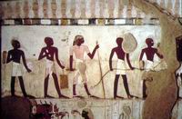
 Smithsonian Magazine is running an article discussing the use of aerial photography in teasing out details of historic land use and man-made features, that may have become obscured over the years... The individuals who are pursuing this area of study are referred to in the article as "landscape archaeologists".
In many ways, surveying and archaeology are closely related, in using historic documentary references to land ownership and retracing and relocating historic evidence of possession in the field. Point of Beginning Magazine (POB) has run several articles in the past of the use of aerial photography to reconcile lines of property ownership.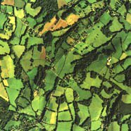
Technorati tags:
archaeology, environment, evidence, geo, history, mapping, news, photogrammetry, remote sensing, science, surveying


0 Response for the " Landscape Archaeologists "
Post a Comment